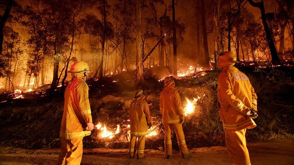
Track Forest Fire From Space
Wildfires have been burning across the state of California for weeks – some of them
becoming larger complexes as different fires merge. One of those was the August
Complex Fire, which reportedly began as 37 distinct fires caused by lightning
strikes
in northern California on Aug. 17.That fire is still burning over a month later.
Individual wildfires and large conflagrations of merged fires were burning throughout
the state and the accumulated smoke they produce make it difficult to see the actual
flaming hotspots from space. But the Moderate Resolution Imaging Spectroradiometer
(MODIS) aboard NASA’s Terra satellite can see the longer wavelengths of nonvisible light
or infrared radiation produced by the heat coming from actively burning wildfires. In
other words, MODIS can sometimes see through smoke even when our eyes can’t by comparing
the higher infrared radiation from hotspots to the lower radiation coming from the
surrounding area.
The MISR instrument also collected information about the amount, size, and
brightness of the particles within the smoke plume based on how the particles
scatter
light at different angles and wavelengths. These data give researchers information
about the characteristics of the wildfire smoke in order to predict how it will move
and
affect air quality.
For example, the southern part of the smoke plume emitted by the
August Complex Fire on Aug. 31 was made of mostly small, dark particles usually
released when a fire is burning intensely. But as the plume moved downwind, the
particles became larger and brighter, possibly because water or other gases emitted
by the fires condensed on the smoke particles.
The August Complex Fire and others this fire season have been sending far-
reaching plumes of wildfire smoke into the atmosphere that worsen air quality in
California and beyond.